This function calculated the projected place of the centroid from a pointset on the sphere.
Usage
surfacecentroid(x, ...)

# S4 method for class 'matrix'
surfacecentroid(
  x,
  output = "polar",
  center = c(0, 0, 0),
  radius = authRadius,
  w = NULL
)

# S4 method for class 'data.frame'
surfacecentroid(x, ...)

# S4 method for class 'SpatialPoints'
surfacecentroid(x, ...)
Arguments
- x
(
matrixordata.frame) Numeric data, XYZ or longitude-latitude coordinates of the set of points.- ...
Arguments passed to the
matrix-method.- output
(
character) The coordinate system of the output points. Can either be"polar"for longitude-latitude or"cartesian"for XYZ data.- center
(
numeric) The center of the sphere in XYZ coordinates (default is 0,0,0).- radius
(
numeric) The radius of the circle in case the input points have only polar coordinates. Unused when XYZ coordinates are entered. Defaults to the authalic radius of Earth ca. 6371.007km.- w
(
numeric) If the points need to be weighed differently, then this can be indicated here. The argument is passed toweighted.mean.
Details
The function calculates the position of the centroid in 3D space (inside the sphere/Earth), which is then projected to the surface.
Examples
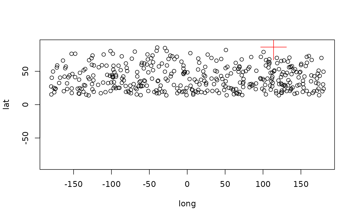
# generate some random points
allData <- rpsphere(1000)
# select only a subset
points<-allData[allData[,3]>1500,]
# transform to 2d
 points2 <- CarToPol(points, norad=TRUE)
# the spherical centroid
sc <- surfacecentroid(points2, output="polar")
sc
#>      long       lat
#> 113.90493  86.28899

#3d plot
plot(points2, xlim=c(-180, 180), ylim=c(-90, 90))
points(sc[1], sc[2], col="red", cex=5, pch=3)